Aller au contenu principal
Voir les favoris
en
Terres-de-Meuse Tourist Office
Discover
Wbt V. Ferooz Pixel Komando Coucher De Soleil Coquelicots
Naturally idyllic
P.12 13 Point Vue Gd Marchin Coup Coeur S. Pêcheur
©
P.12 13 Point Vue Gd Marchin Coup Coeur S. Pêcheur
"Once upon a time …
Wbt Denis Closon Namur
Calling all enthusiasts!
Chapelle et château de Vervoz
©
Chapelle et château de Vervoz
7 days in Terres-de-Meuse
Château et église de Saint-Fontaine
6 good reasons to rediscover Terres-de-Meuse
Legumes
©
Legumes
Local products
1 destination, 4 ambiances
Meuse Valley, vineyards and feet in the water
Burdinale-Mehaigne Nature Park, a nature bath
The Hesbaye, Belgium's granary
The Condroz, between stalks and chavées
Adobestock 116870042 C Wavebreakmediamicro
©
Adobestock 116870042 C Wavebreakmediamicro
My prettiest walk
To live here
Famille Adobestock 144206675 C Liderina
Low-cost activities
Un couple souriant et leur fille en train de caresser leur chien dans un parc
With your 4-legged friend
Une jeune femme tout sourire avec un parapluie
Top 10 things to do when it rains
Un marchant offrant une pomme à un client
A market for every day
Famille heureuse couché dans l'herbe
In the family
Et aussi...
Leisure
Sporting activities
Romantic weekend
Bachelor or bachelorette parties
Coming as a group
Sélection du printemps
Le top de l’été
Frissons et saveurs d’automne
Hiver et confettis
Preparing my stay
How do I get there?
Tourist information
Brochures
Weather
Contact
roadBOOK
065 Naxhelet C Naxhelet
Where to sleep?
Huy - restaurant La Tour Colombes
©
Huy - restaurant La Tour Colombes
Where to eat?
Adobestock 2156 C Rh2010
Where to get a drink?
Agenda
Château de Fallais
©
Château de Fallais
Festival of guided tours
Une dame souriante sur son vélo en balade pour des découvertes
Velexplorers
Nuit.des.fanfares C Laurence Noel
©
Nuit.des.fanfares C Laurence Noel
All events
Brocante
©
Brocante
Brocantes & Markets
Hannut Cortege Folklorique Du 21 Juillet C Jc Dubois
©
Hannut cortège Folklorique
The must-haves
See photos (4)
Back to the list
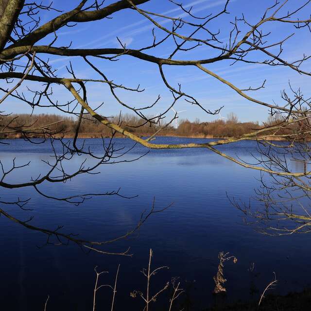
La Réserve Naturelle du Haut-Geer
Walking/pedestrian
in Hollogne-sur-Geer
Download
Points of interest
Difference in height
Comments
Added to wishlist
Add to wishlist
Download
Points of interest
Difference in height
Comments
Warning: Unsecured hours
4.4
km
Loop
Walking/pedestrian
1h 15min
Very easy
Departure
Hollogne-sur-Geer
Difference in height
49.06 m
Documentation
GPX Trace
KML File
GPX / KML files allow you to export the trail of your hike to your GPS (or other navigation tool)
See all reviews
Points of interest
A
1
B
C
D
2
E
3
F
G
4
A
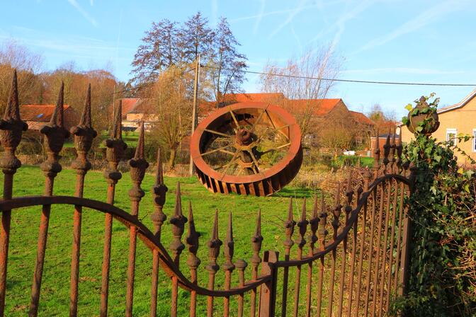
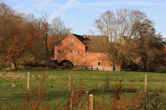
Moulin castral d'Hollogne-sur-Geer
MICE - INFRASTRUCTURE
Geer
From
1
January
until
31
December
Le Bistrot du Moulin castral
RESTAURANT
Geer
1
B
C
D
2
E
3
F
G
4
49 meters of difference in height
Start altitude :
117 m
End altitude :
117 m
Maximum altitude :
130 m
Minimum altitude :
116 m
Total positive elevation :
49 m
Total negative elevation :
-49 m
Max positive elevation :
5 m
Min positive elevation :
-8 m
×
Sélectionnez les options d'impression …
Imprimer le titre et la description
Imprimer les étapes
Imprimer les points d'intérêts
Imprimer les photos des points d'intérêts
Imprimer le graphique de dénivelé
Imprimer la carte
Close
Popular searches
{% label %}
Page suggestions
La Réserve Naturelle du Haut-Geer
Adobestock 116870042 C Wavebreakmediamicro
©
Adobestock 116870042 C Wavebreakmediamicro
|
Wavebreakmediamicro Adobestock
My prettiest walk
La Réserve Naturelle du Haut-Geer
Filter search
Page types
All
Articles
Agenda
Lists
Aucun résultat
/
English
Français
Nederlands
Deutsch
Close
×